Catalog Data Refresh: Updates to GEE Community Catalog Release 2.5.0
What has changed since the last release of the Awesome GEE Community Catalog last month? This along with updated catalog stats for release 2.5.0. Get your data dose for the week.
Last month was a busy one with a focus on some under-the-hood improvements to the overall data JSON, which now includes URL links to each dataset as well as thematic section information and license dataset. This makes programatic access of these datasets even easier and more robust. I have managed to also add three new datasets and a quick update to an existing one as we worked on those improvements. In this post, we'll delve into the datasets that make up this months release with more detailed deep dives coming up in upcoming articles. Add your email to subscribe to the newsletter if you haven’t already so you can get this summary and more deep dives delivered directly to your email.
Read till the end to find out about what’s coming this Thursday.
Our community catalog now boasts over 1730 datasets 📊, comprising over 355 TB of data 💾. In the past month, we've welcomed over 373 thousand visits/hits from 156 countries 🌍. With over a million+ images and 3 billion+ features across almost a thousand feature collections find out what you can do with these community commons. You can find below and book the catalog stats page here
The Ookla Global Fixed and mobile network speed test dataset got updates over the last two quarters of 2023 now included in the collection
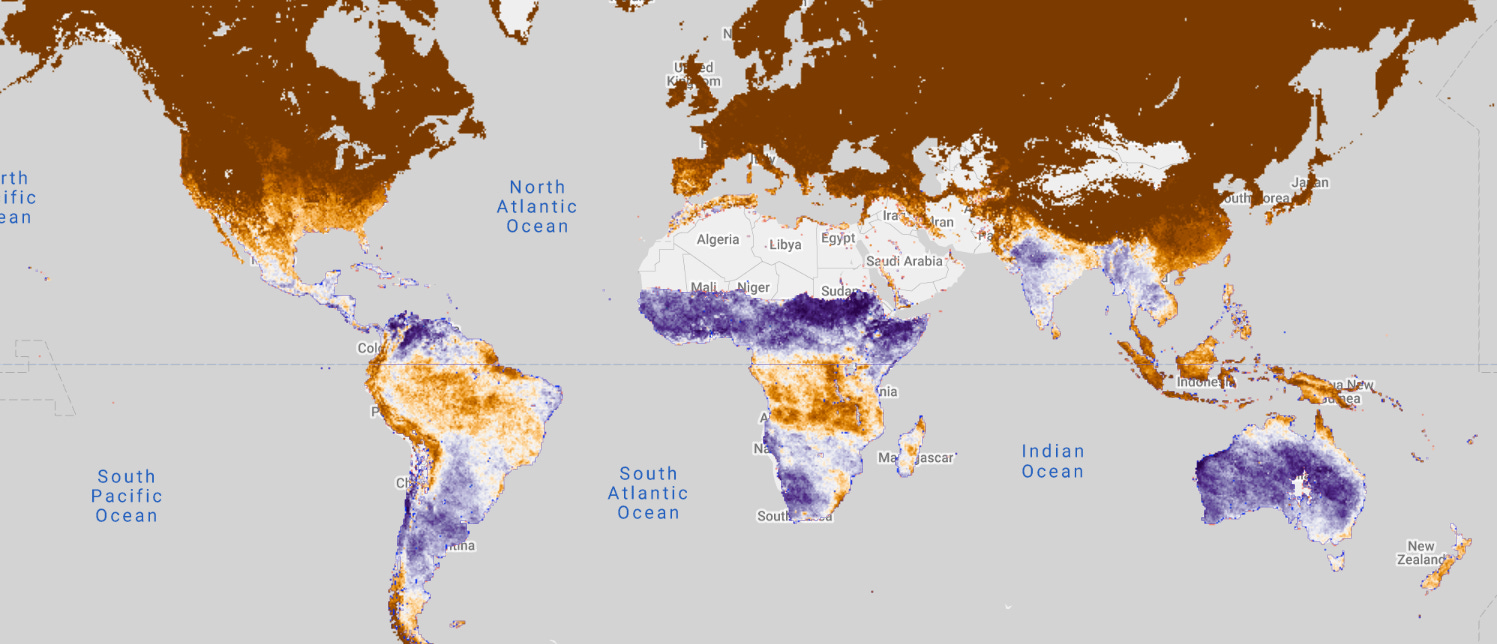
The ESA Fire Disturbance Climate Change Initiative (CCI) project has generated global burned area maps using satellite data. The AVHRR - LTDR Pixel v1.1 product, discussed here, presents gridded data derived from the AVHRR Land Long Term Data Record (LTDR) v5 dataset by NASA. This dataset offers monthly insights into global burned area at a spatial resolution of 0.05 degrees from 1982 to 2018.
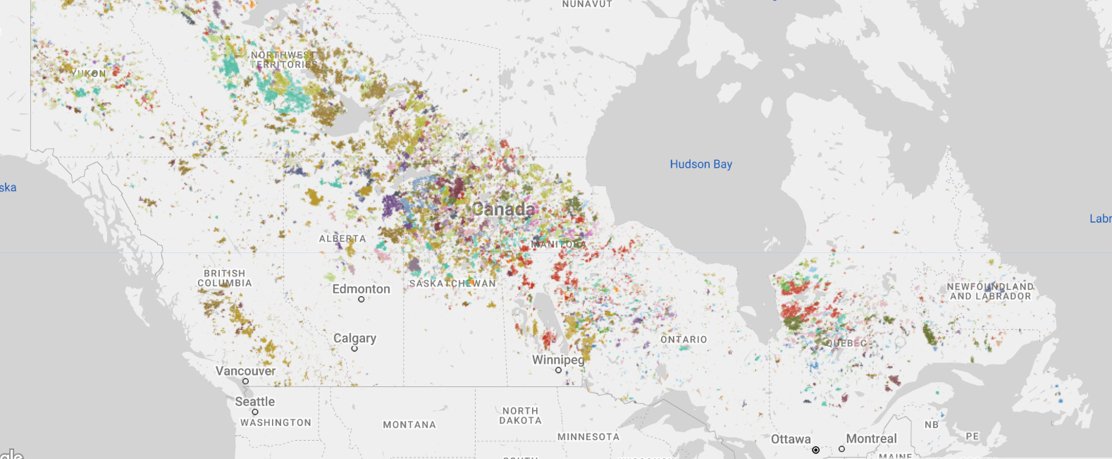
The National Burned Area Composite (NBAC) is a GIS database and system designed to calculate forest area burned at a national level since 1986. It aids in estimating carbon emissions in Canada by evaluating various data sources and techniques to map fires. The best available data source for each burned area is chosen, resulting in a national composite picture. NBAC is part of the Fire Monitoring, Accounting, and Reporting System (FireMARS), developed by the Canada Centre for Mapping and Earth Observation and the Canadian Forest Service with initial funding from the Canadian Space Agency Government Related Initiatives Program.
This dataset assesses soil erosion dynamics in Pakistan from 2005 to 2015 using the Revised Universal Soil Loss Equation (RUSLE) and six key factors. It categorizes erosion rates into four classes and highlights a national-scale increase from 1.79 to 2.47 ton ha⁻¹ yr⁻¹. The findings reveal shifts in erosion intensity and spatial patterns, driven by population growth, infrastructural development, and resource exploitation. You can read the full paper here.
This dataset quantifies the extent and rate of annual change in surface water area (SWA) across India's rivers and basins over 30 years from 1991 to 2020. It does so by season (annual dry, wet, and permanent water, based on India's seasons) and at two spatial scales: the river basin scale (1516 level-7 basins from HydroBASINS) and the finer river reach scale (68,367 reaches).
Last but not least we wrote a whole post just on this one
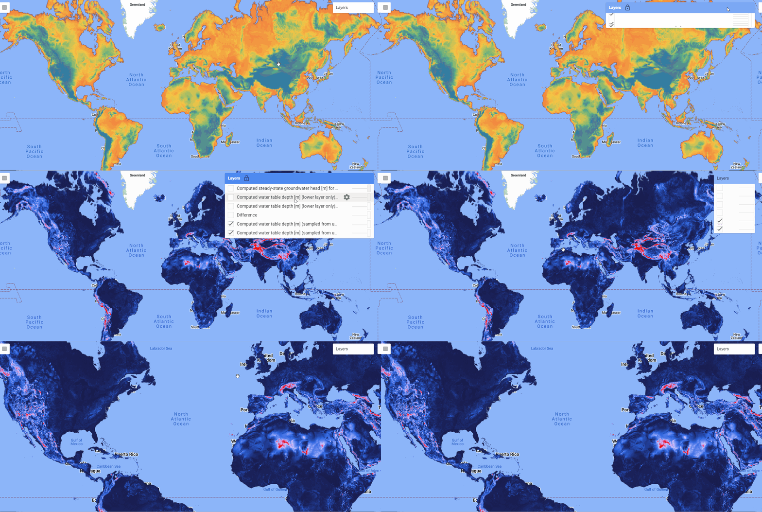
The GLOBGM v1.0 dataset marks a significant milestone in global groundwater modeling, offering a parallel implementation of a 30 arcsec PCR-GLOBWB-MODFLOW model. Developed by Jarno Verkaik et al., this dataset presents a comprehensive understanding of global groundwater dynamics at a spatial resolution of approximately 1 km at the Equator. Leveraging unstructured grids and a prototype version of MODFLOW 6, the research team has meticulously partitioned the Earth's surface into independent grids, totaling a staggering 278 million active cells.
Upcoming datasets in the pipeline include access to Global Glacier Elevation change products and much more.
Your involvement is crucial for keeping this project thriving. If you love what we're doing, why not give our GitHub repository a star ⭐️to help spread the word and boost visibility? Let's connect on Linkedin and Github to collaborate, share dataset ideas, provide valuable feedback, and join the exciting conversation! 💬🤝 This and so much more to come over the next few weeks.


