
Data with a Purpose: Nearly 4000 Datasets and our view from Above
As the line between data & action in earth observation grows thinner each day. With Release 3.3.0, the GEE Community Catalog isn't just getting bigger, it's getting more connected.

The Numbers That Tell a Story: 4,000+ Datasets and Growing
When I launched the awesome-gee-community-catalog back in 2020, I never imagined we'd be approaching the 4,000-dataset milestone quite quickly. In this release alone, we've added over 5 terabytes of data, enough to fill over 1,000 DVDs. Yet the raw numbers only hint at what's really happening here. This isn't just digital weight; it's the collective intelligence of a global community finding new ways to monitor our changing planet.

Release 3.3.0 brings more than just datasets. We've added two game-changing features that transform how our community interacts: a dedicated discourse forum you can join here , where users can share insights, troubleshoot challenges, and build collective knowledge.
Want to see how easy it is to get started with our new forum? Check out this guided tour:
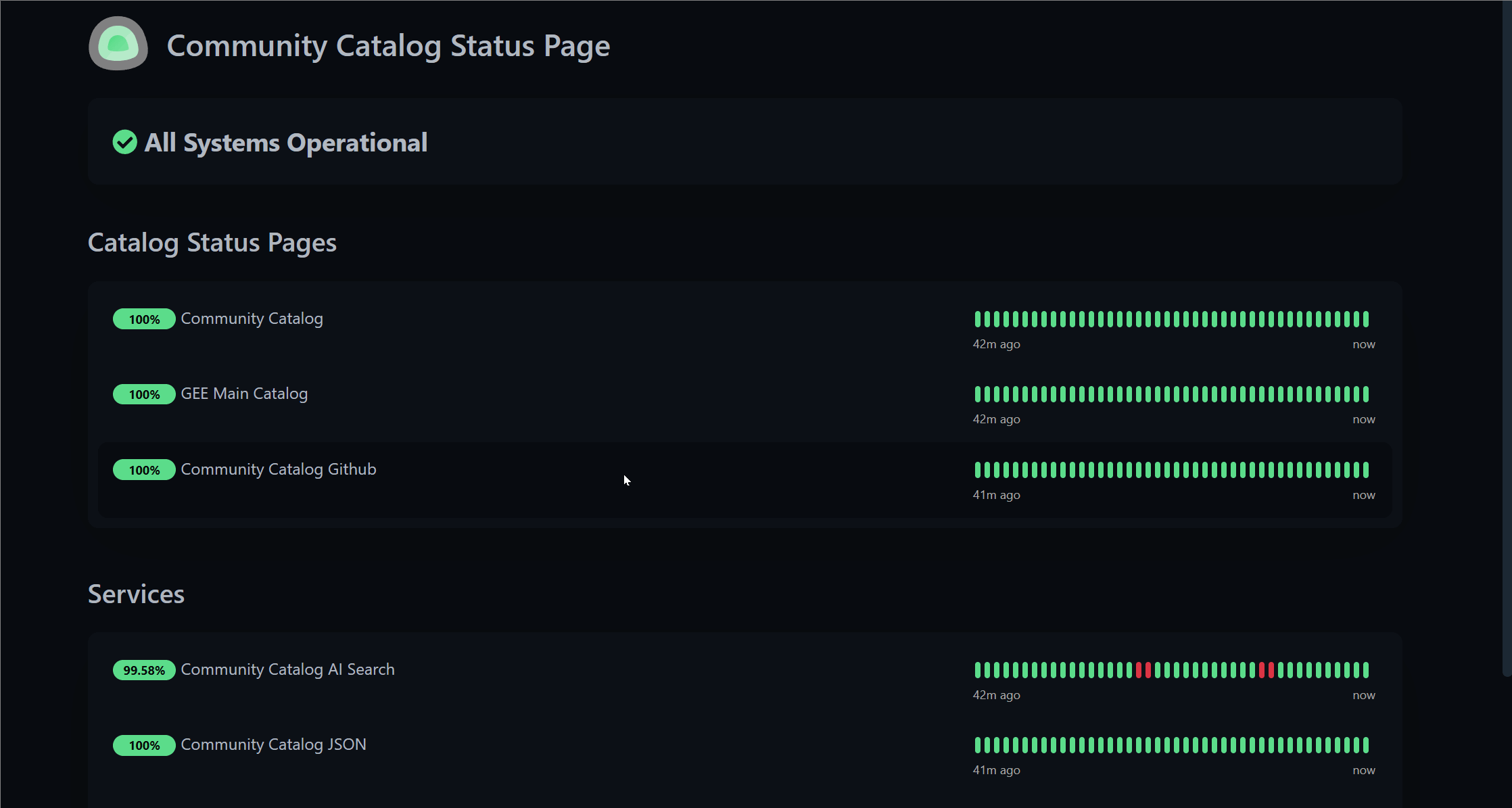
Anyone who's ever depended on digital infrastructure knows that reliability isn't optional it's fundamental. Our new uptime monitor brings transparency to our system's health, letting users check service status before beginning critical workflows. The monitor tracks our website, and core infrastructure, providing real-time visibility into the digital backbone that supports our growing data commons. Think of it as opening the hood and inviting everyone to look inside because transparency builds trust, and trust builds community.
When Pixels Tell Personal Stories
The power of Earth observation has always been its ability to reveal hidden narratives, the slow march of urban growth, the scars left by wildfires, the hopeful expansion of solar farms across once-barren landscapes. Each dataset in our catalog tells a story, and our February updates add particularly compelling new chapters.
Take the Los Angeles Fires 2025 Lidar Collections. These aren't just point clouds; they're three-dimensional time capsules capturing a city's loss and resilience after the devastating Palisades and Eaton fires. When Neal Driscoll of UC San Diego's ALERT California program says these fires "tore apart the lives, homes, businesses and neighborhoods of thousands of Angelenos," he's reminding us that behind every pixel is a personal story of loss and recovery.

Or consider the TransitionZero Solar Asset Mapper, now updated through Q4 2024. In those simple polygons outlining solar installations, we're watching nothing less than an energy revolution unfold in real-time.

As someone who's spent countless hours staring at satellite imagery, I still find myself marveling at how these datasets let us witness history as it happens.
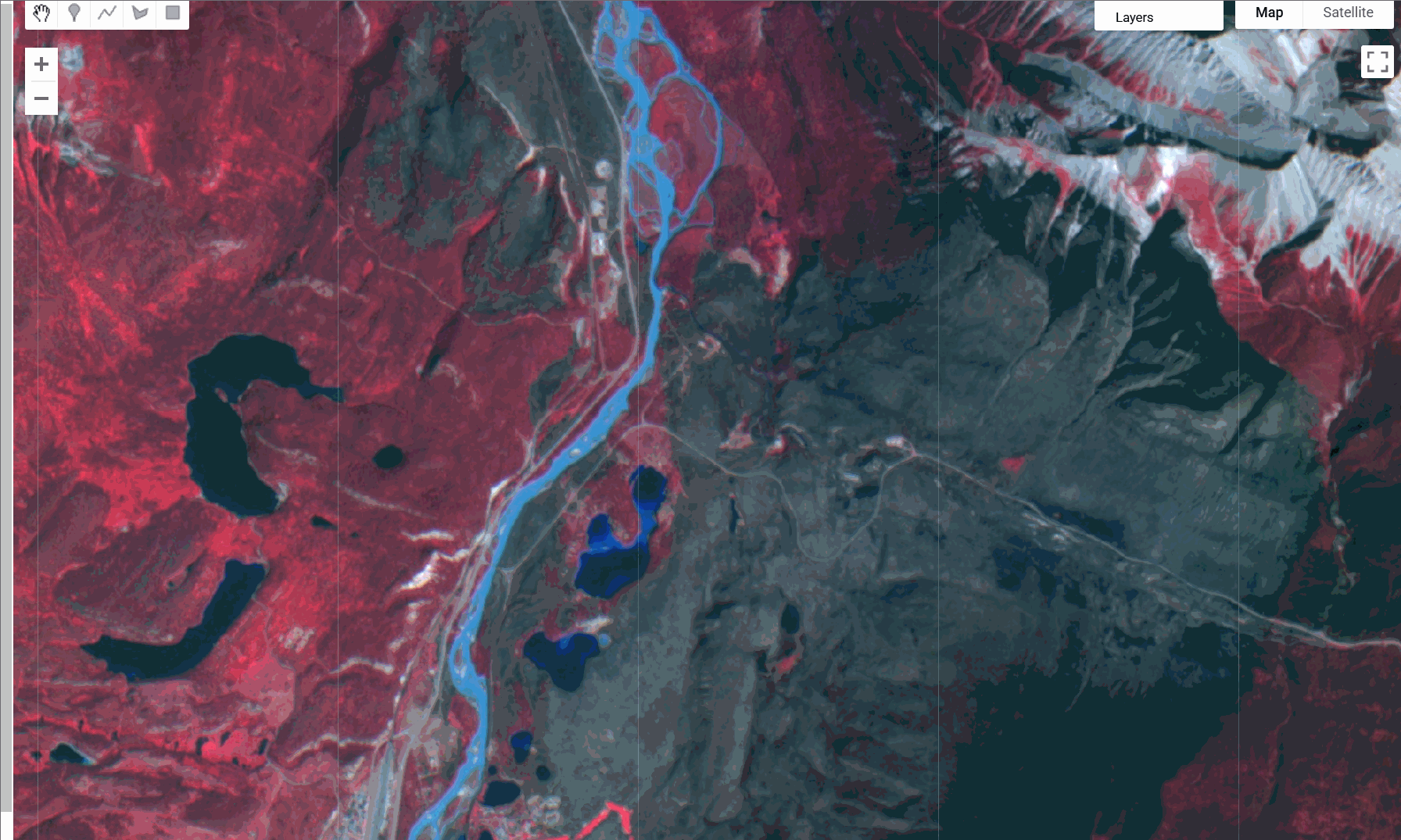
What Hyperspectral Eyes Can See
I'm particularly excited about two newcomers to our catalog: Wyvern and Urban Sky. These aren't just new data sources; they represent fundamental shifts in how we observe Earth.
Wyvern's hyperspectral imagery sees what human eyes cannot; hundreds of spectral bands revealing plant health, water quality, and mineral compositions in unprecedented detail. When Wyvern co-founder Callie Lissinna says they created the company "to make Earth better from space," it resonates with our own mission. Their commitment to releasing free monthly datasets exemplifies the kind of open science ethos that drives our catalog forward.
Meanwhile, Urban Sky's stratospheric micro balloons offer 10cm-resolution imagery at a fraction of traditional aerial survey costs. This middle ground between aircraft and satellites represents exactly the kind of innovative approach we need finding creative solutions to persistent Earth observation challenges.
The Rhythm of Seasons and Pulse of Plants
The Multi-Source Land Surface Phenology dataset might not sound immediately exciting, but it reveals the rhythm of seasons across North America captured at 30-meter resolution. By tracking when plants green up, reach maturity, begin to decline, and go dormant, we're essentially recording Earth's vital signs how forests breathe, how crops grow, how ecosystems respond to our warming world.

Similarly, the Global Microwave Vegetation Optical Depth Climate Archive (VODCA v2) measures what optical sensors cannot: the water content within plants, visible even through clouds. In an era when climate change is altering rainfall patterns worldwide, this ability to monitor vegetation moisture regardless of weather conditions becomes increasingly vital.
From Data to Discourse: Building the Knowledge Commons
The GEE Community Catalog has always been more than a data repository; it's a knowledge commons. But knowledge isn't just stored it's exchanged, debated, refined, and applied. That's why I'm so excited about our new discourse forum as a place to have these discussions around around dataset applications, technical workflows, and research methodologies.
If you haven’t signed up already sign up and start chatting with so many features you wouldn’t find in your google groups chat. Including better search, summarization and exporting your chats out.
Communities Are What Communities Build
The phrase that keeps coming back to me as I look at Release 3.3.0 is simple but profound: communities are what communities build. Every dataset in our catalog exists because someone decided to share their work. Every forum discussion happens because people choose to contribute their knowledge rather than keep it siloed.
When we launched in 2020, the catalog was primarily my project my attempt to make community requests come alive. Today, it's something much bigger: a collaborative effort involving data providers, users, developers, and Earth scientists worldwide. The wetlands mapped in the Global Lakes and Wetlands Database, the fire scars tracked in the Canada National Burned Area Composite, the drought conditions monitored in the USDM these aren't just interesting datasets; they're the tools communities need to understand and address our most pressing environmental challenges.
Data becomes meaningful when it helps us see the world more clearly and create conversations and narratives around actions using that data.
Join the Journey
Curious about what's on the horizon? Our changelog is your window into the future, showcasing the latest updates to the GEE Community Catalog. From groundbreaking new datasets to innovative features, each entry is a stepping stone toward a more comprehensive understanding of our planet. Join the discourse forum and chat with other users.
If you're inspired by our mission, consider becoming a part of it. Sponsoring the project or simply giving our GitHub repository a star ⭐️ may seem like small gestures, but they're vital. These actions help expand our reach, attract more contributors, and ultimately enhance the catalog's impact on Earth science and environmental stewardship. Connect with me on LinkedIn and GitHub to share your insights, provide feedback, or join the ongoing conversation.🌍✨