Insights to Enhancements: Unpacking GEE Community Catalog Release 3.1.0
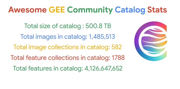
Explore the latest with over Half a Petabyte of datasets, AI powered search, new papers, apps, feature improvements & more 2,700 datasets with GEE Community Catalog 3.1.0
With each release, the Awesome GEE Community Catalog strives to bring meaningful improvements to its extensive dataset library. We cannot build better without feedback and insights from those who help us build the catalog. So it is is apt that we share little and large victories with the community. The latest version 3.1.0 is no exception.
This update not only expands the dataset offerings—now over 2,700 datasets and more than half a petabyte of data but also introduces powerful new tools and improvements designed to enhance usability and data exploration. Here’s a deep dive into what’s new and why it matters.
Advancing Research with Community Catalog
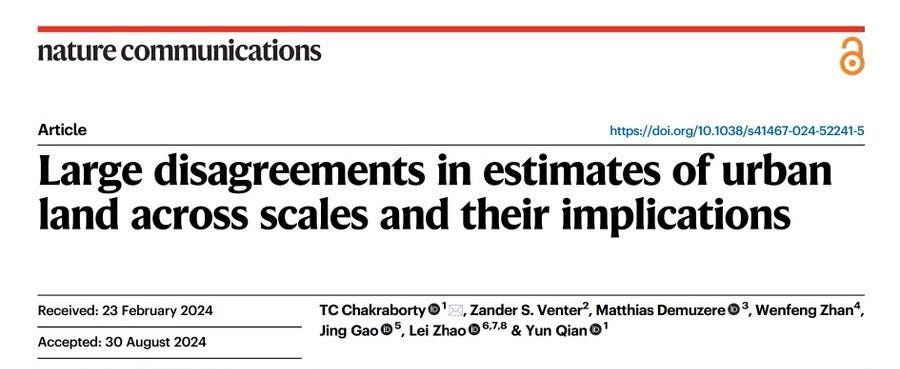
We are supporting the scientific community and the community catalog was built to make accessing data more easily and building on top of it. Here is a paper that TC and others published where the community catalog played a role.
Also, while each dataset in the community catalog has their own citation, please include the community catalog in your citation too, you can find the latest citation information here.
In response to user feedback, the catalog now includes thumbnails for each dataset within the catalog’s JSON file. These thumbnails offer a quick, visual reference for each dataset, making it easier to identify and explore the available options. These are useful to both the Gemini Search Results as they the search is grounded with the catalog website and the dataset JSON and the Catalog Browser
Supercharge Your Search with Gemini and the Ask AI Button
Tired of sifting through keywords? No problem! We've integrated the powerful Gemini search engine, allowing you to ask natural language questions about datasets you need. Stuck on flooding trends?
Just ask "find datasets on flooding." Feeling curious about biodiversity analysis.” Simply inquire "how to study biodiversity with GEE datasets?"
Pro Tip: Instead of entering keywords, try asking questions like, "What datasets help analyze biodiversity?" or "How can I study urban flooding?"
The Ask AI button is now available on every page and links directly to the search page allowing you to ask questions about datasets in the community catalog providing you with a summarized result.
Catalog Thumbnails and a Brand New Browser
Ever wished for a more visual way to explore the community catalog datasets? Here’s another way for you to explore all datasets across the catalog. I have enriched the catalog JSON file with potential thumbnails for each dataset. This paves the way for the all-new Catalog Browser, it's a work in progress and you can explore it right here
Datasets are neatly grouped by thumbnail, with integrated dark and light modes, links to documentation, sample code, and more. Plus, the browser is fully searchable, allowing you to refine your search and see the dataset count update dynamically.
Data Highlights and Apps
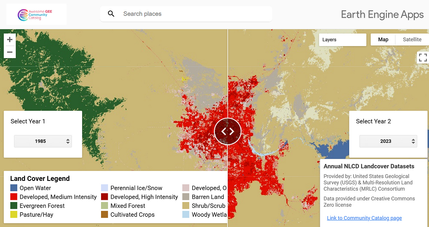
One of the most significant additions to this release is the Annual NLCD Dataset from the U.S. Geological Survey (USGS). This dataset offers insights into Land Cover changes across the U.S from 1985-2023. You can now browse land cover between any two years using a simple Earth Engine app here
Apart from this, this release also contains Global Land Cover Estimation (GLanCE) and all of gNATSGO (gridded National Soil Survey Geographic Database) database which is a composite database that provides complete coverage of the best available soils information for all areas of the United States and Island Territories are now available in the community catalog.
Annual NLCD Land Cover Dataset
The USGS Land Cover program combines methodologies from the National Land Cover Database (NLCD) and Land Change Monitoring, Assessment, and Projection (LCMAP) projects, enhanced with deep learning techniques, to deliver a comprehensive suite of land cover datasets. Known as the Annual NLCD Collection 1.0, this data spans from 1985 to 2023 and includes six products that capture various aspects of U.S. land cover, including general land cover, change detection, confidence levels, impervious surface measurements, and spectral change data.
These datasets rely on Landsat data, supporting applications like urban growth analysis, agricultural management, wetland monitoring, and climate impact assessments.
As mentioned we have added an app to look at annual updates along with the additional layers that are available such as confidence scores allow resource managers and decision-makers to monitor trends effectively and plan for sustainable land use.
Global Land Cover Estimation (GLanCE)
The Global Land Cover Estimation (GLanCE) dataset offers a comprehensive, high-resolution record of annual land cover and land cover changes worldwide (excluding Antarctica) from 2001 to 2019. Based on Landsat imagery with a 30-meter spatial resolution, this dataset employs the Continuous Change Detection and Classification (CCDC) algorithm to identify and track land cover and changes. It includes 10 Science Data Sets (SDSs) that monitor land cover classifications, land cover changes, and greenness dynamics, allowing for detailed analyses of ecological patterns and trends.
The GLanCE SDSs are grouped into three main categories. The Land Cover and Change category includes four SDSs that provide data on land cover class, quality estimates, previous land cover in changed areas, and the approximate day of year (DOY) when changes occurred. Greenness Dynamics comprises four SDSs focused on greenness, measured using the Enhanced Vegetation Index (EVI2), and tracks metrics such as median greenness, amplitude, rate of change, and magnitude of change. Finally, Leaf Type and Phenology includes two SDSs that determine leaf type and phenology for tree-covered areas.
gNATSGO (gridded National Soil Survey Geographic Database)
The gNATSGO (gridded National Soil Survey Geographic Database) database is a composite database that provides complete coverage of the best available soils information for all areas of the United States and Island Territories. The update now includes all layers.
The newly added Global Dam Tracker (GDAT) and Global Dam Watch (GDW) v1.0 databases provide unmatched insights into global dam infrastructure, supporting hydrological analysis, environmental assessments, and socioeconomic studies. These datasets offer the most comprehensive geo-referenced global dam information available, with detailed attributes like completion year, dam height, purpose, and capacity.
Global Dam Tracker cover over 35,000 dams worldwide including feature attributes and Global Dam Watch consists of 41,145 river barriers and 35,295 reservoir polygons with attributes
Finally I have added a wealth of other valuable datasets, including Global Natural and Planted Forests, Amazonian Peatland Extent, Canada Long Term Tree Species data and more and we want you to explore the changelog for an always updated links.
Curious about what’s next? Check out our changelog for the latest updates on the GEE Community Catalog, from new datasets to innovative features, with direct links to explore each addition. If you're inspired by our work, consider sponsoring the project or giving our GitHub repository a star ⭐️small actions that help expand and enhance the reach of our community catalog.
We’d love to hear from you! Connect with us on on Linkedin and Github to share your ideas, provide feedback, or join the conversation. 🌍✨


