Paper Trails to Pixels: Historical USGS Topo Maps in Google Earth Engine Community Catalog
This week deep dive and revisit with me USGS Historical Topo maps from 1900s-2006 across the US. How I added over 100,000+ georeferenced topo maps and how you can bring them to your use case.
This is an update to the medium blog I wrote earlier but considering I have added a few new states, made some code updates and I have opened up the data broadly a revisit seems apt. Even better I get to post this while visiting the USGS Headquarters in Reston at the heart of the USGS topo maps so I hope you take a few minutes, and go browse an area you like, turn back time just a bit, and enjoy the read. If you like stories like these and want them straight in your inbox or want to be alerted about them add your email to subscribe to the newsletter.
Maps have historically been indispensable aids for comprehending and traversing our surroundings. An eminent set of maps that has held pivotal importance in the United States is the USGS (United States Geological Survey) Topo Maps. The USGS Topo Maps, a prominent series in the United States with a rich history dating back to the 1800s, continues to be a valuable resource. Notably, the 1:24,000 scale stands out for its remarkable balance between detail and coverage, exemplifying its significance.
The genesis of USGS Topo Maps can be traced back to the late 19th century when the USGS initiated an ambitious endeavor to meticulously map the entirety of the United States. Among the various scales employed, the 1:24,000 scale, also referred to as 7.5-minute quadrangle maps, emerged as one of the most prevalent. Covering an area of 7.5 minutes of longitude and latitude per sheet, these maps offer a detailed depiction spanning approximately 64 square miles (166 square kilometers). Over time, they have become indispensable tools for a multitude of endeavors, ranging from scientific research to land use planning and recreational exploration.
Getting to the Data
The U.S. Geological Survey recognized the value of preserving historical USGS Topo Maps. They embarked on a project to scan and georeference thousands of these maps across the United States, encompassing various scales. Recognizing the paramount importance of the 1:24,000 scale, I embarked on the task of downloading over 81,000 maps, expanding the collection to a total of 109,974 topo maps dating from the 1900s to approximately 2006, representing the most recent addition.
In some instances, they feature ortho photomosaics, augmenting their utility with aerial photographs that have undergone orthorectification to correct distortions caused by Earth's curvature and terrain variations. The inclusion of such imagery enriches the comprehension of historical landscapes. Complementing the map scans, an index or grid at the 1:24,000 scale was acquired, facilitating users in pinpointing the precise location of each map.
topoView page to download USGS historical quads
Preprocessing and removing map collars
The task of incorporating thousands of maps, amounting to over 9.14 terabytes of data, into the Google Earth Engine collection posed significant challenges. Nonetheless, the endeavor proved immensely rewarding, as this extensive repository of historical maps now affords researchers, historians, and enthusiasts an unparalleled opportunity to delve into the past. From tracing the evolution of landscapes over time to juxtaposing historical and contemporary features, the potential for exploration and visualization is limitless.
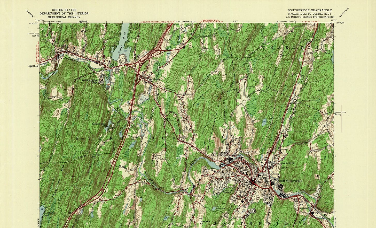
USGS topo map in Earth Engine with collar
A notable hurdle emerged during the process of merging individual map sheets, primarily due to the presence of collars. These collars contain crucial metadata, including map legends and other details, yet they hinder the seamless integration of adjacent maps.
USGS map index 1:24000
To surmount this obstacle, a dedicated function was devised to leverage the 1:24,000 map index layer. By selectively removing the collars, the maps could be more or less precisely aligned, resulting in a cohesive and comprehensive portrayal of the region. Additionally, metadata augmentation was implemented to include region and location information in the map collection metadata, enhancing the potential for aggregation and analysis.
USGS topo map in Earth Engine without collar
Earth Engine Tips: Randomize Collection
Finally, I wanted the sample script to zoom into a random part of the collection every time. Earth Engine allows you to call some native javascript calls such as Math operations which can be used to generate for example random numbers can be generated within a range using this
// Generate a random number between 1 and x (exclusive)
var randomNumber = Math.floor(Math.random() * x) + 1;
This can then be used to center on a part of the collection using a true subset
//Center Object onto a random image in collection
var items = usgs_topo.toList(randomNumber); //Get random number generated
var item = ee.List(items).shuffle(false); //Shuffle the items in list
var image = ee.ImageCollection(item).first(); //First item from collection
Map.centerObject(image,10)
Try the sample script here
The USGS Topo Maps collection at the 1:24,000 scale offers a captivating portal into America's cartographic past, unveiling invaluable insights into the nation's ever-evolving landscapes. Through this endeavor, I have had the privilege of sharing my passion for historical cartography with others, while paying homage to the remarkable evolution of map-making techniques and the enduring significance of cartography in our quest to comprehend the world around us.
If you appreciate these efforts, please consider giving the GitHub repository a star ⭐️ or simply share the newsletter and blog with someone you know and appreciate. This simple gesture helps increase the visibility of our work and spreads awareness about the community catalog.


